Geospatial Basics
Latitude, Longitude, X, Y
Latitude (NS point) and Longitude (EW point) are coordinates that can be used to define a spatial location. Note that in US referencing systems, longitude often corresponds to Y while latitude corresponds to X. It is essential to check the GIS system or DB documentation for the correct order of the coordinates.
For example, Southampton has a latitude of 50.90deg N, 1.40deg W, which can also be expressed as integers 50.90 and -1.40. In terms of X and Y, it is (-1.40,5.90).
For example, to view the map of Southampton, one can put the lat,lon coordinates into a map service like OpenStreetMaps. 14 is the zoom level, 50.9019 is the latitude and -1.3996 is the longitude.
https://www.openstreetmap.org/#map=14/50.9019/-1.3996
WGS84
The earth is not a perfect sphere but a geoid. The World Geodetic System defines an accurate model of the shape of the Earth, comprising a coordinate system and other models for altitude and sea level. WGS84 is the latest revision (in the year 1984) and the reference coordinate system used in the Global Positioning System.
WGS84 is also commonly known as EPSG 4326 which is the EPSG reference id for WGS84. If you're really going to pick a nit: EPSG 4326 defines a full coordinate reference system, providing spatial meaning to otherwise meaningless pairs of numbers. It means "latitude and longitude coordinates on the WGS84 reference ellipsoid." - Answer on Stackexchange
Mercator Projection
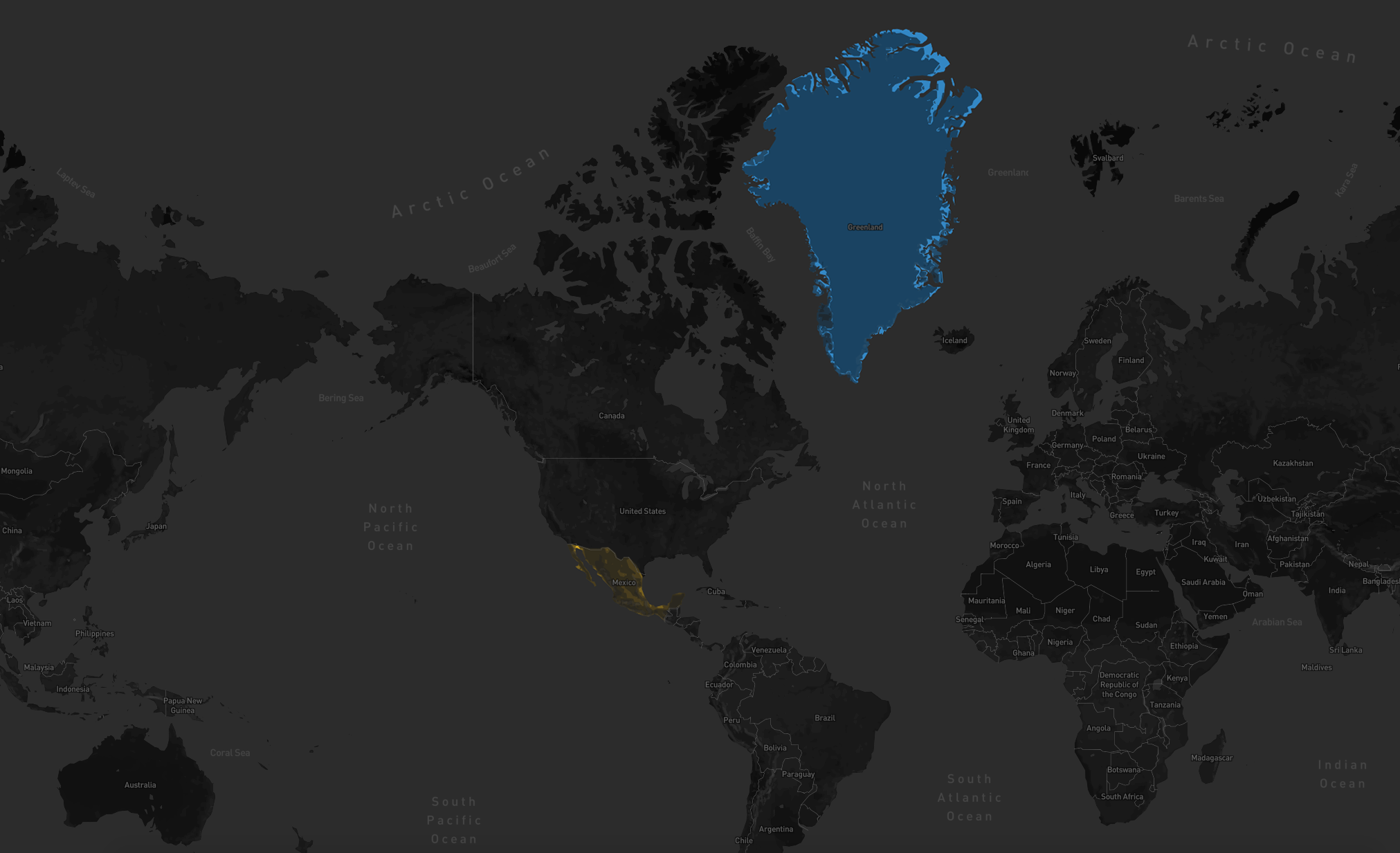
If we look at a flattened world map itself, Greenland looks deceptively big, many times the size of Mexico. However, greenland is 2.166 million km² while Mexico is 1.973 million km² and Canada is 9.985 million km². This is because in Mercator projection maps, land masses farthest away from the equator are distorted in size. Mercator tends to spread the meridians apart near the poles, any landmass to the North (or South, though there are fewer land masses there) will look disproportionally large, compared to landmasses nearer the equator. Just look at a globe. You will see how the meridians(lines of longitude) converge at the North pole. Look at a Mercator projection. You will see those lines spread out so they are the same spacing as nearer the equator.